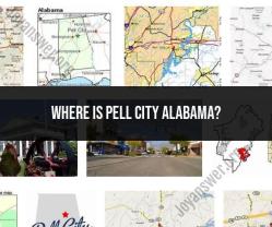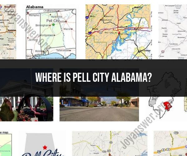
Where is Pell City Alabama?
Pell City is a city located in the state of Alabama, United States. It is situated in St. Clair County and is a part of the Birmingham metropolitan area. Pell City is located in the central part of Alabama, northeast of Birmingham. Here are some insights about the location of Pell City, Alabama:
Geographic Coordinates:
- Latitude: Approximately 33.5861° N
- Longitude: Approximately 86.2864° W
Relative to Nearby Cities:
- Pell City is located to the northeast of Birmingham, which is the largest city in the region.
- It is also relatively close to cities like Trussville and Moody.
Access to Major Roads:
- Pell City is accessible via Interstate 20, a major east-west highway that passes through the city. This provides convenient transportation links to other parts of the state.
Proximity to Natural Features:
- The city is situated near Logan Martin Lake, a reservoir on the Coosa River. This provides opportunities for recreational activities such as boating, fishing, and water sports.
Local Landmarks:
- Downtown Pell City features a variety of local shops, businesses, and eateries.
- The city has its own municipal airport, St. Clair County Airport, providing aviation services to the area.
Please note that geographic information is subject to change over time, so it's recommended to verify the specific location details using current maps or navigation tools. If you're planning to visit or need more precise directions to Pell City, using a mapping application or GPS navigation system will provide you with accurate information to reach your destination.