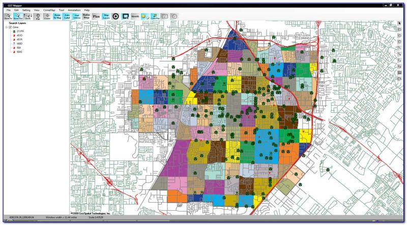
How do I map crime and geographic information systems district?
Mapping crime using Geographic Information Systems (GIS) involves the integration of crime data with spatial information to analyze and visualize patterns, trends, and relationships. Here's a step-by-step guide on how to map crime using GIS:
1. Collect Crime Data:
- Obtain accurate and up-to-date crime data for the district you are interested in. Crime data may include information on the type of crime, date and time, location, and other relevant details. This data is typically provided by law enforcement agencies.
2. Understand GIS Software:
- Choose a GIS software or platform that suits your needs. Common GIS software includes ArcGIS, QGIS, and Google Earth Engine. Familiarize yourself with the basic functionalities of the chosen GIS tool.
3. Prepare Spatial Data:
- Acquire or create spatial data for the district, such as boundaries, streets, and other relevant geographic features. Ensure that the spatial data is in a compatible format for your GIS software (e.g., shapefile, GeoJSON).
4. Import Data into GIS:
- Import both the crime data and the spatial data into your GIS software. Ensure that there is a common identifier (e.g., location or ID) in both datasets, allowing them to be linked.
5. Geocode Crime Locations:
- If the crime data includes addresses or location descriptions, geocode the data to convert textual information into geographic coordinates (latitude and longitude). Many GIS tools have geocoding capabilities.
6. Create a Map Layer:
- Use the spatial data to create a map layer for the district. This layer provides the backdrop for visualizing the crime data. Customize the appearance of the map layer to enhance clarity.
7. Overlay Crime Data:
- Overlay the geocoded crime data onto the map layer. This process allows you to see where crimes are concentrated, identify patterns, and analyze spatial relationships.
8. Symbolize and Categorize Crime Data:
- Symbolize the crime data on the map by categorizing it based on crime types or severity. Different symbols or colors can represent different types of crimes, making it easier to interpret the map.
9. Add Contextual Information:
- Enhance the map by adding contextual information, such as demographics, socio-economic data, or other relevant factors that may influence crime patterns. This can provide a more comprehensive understanding of the spatial relationships.
10. Spatial Analysis:
- Conduct spatial analysis to identify clusters, hotspots, or trends in the crime data. GIS tools offer various analytical methods, such as density mapping, spatial autocorrelation, and hotspot analysis.
11. Create Visualizations:
- Generate visualizations, such as heat maps, charts, or graphs, to effectively communicate the patterns and trends identified in the crime data. This can be useful for presentations or reports.
12. Interpret Results:
- Analyze the mapped data to draw meaningful conclusions about crime patterns and spatial relationships. Consider the implications for law enforcement, urban planning, and public safety.
13. Update and Monitor:
- Regularly update the crime data and spatial information to maintain the relevance of your maps. Monitoring changes over time can provide insights into the effectiveness of interventions or policy changes.
Mapping crime using GIS is a powerful tool for crime analysis and decision-making. It allows stakeholders to make informed decisions about resource allocation, crime prevention strategies, and community engagement based on spatial patterns and trends.
What methodologies or tools can be used to overlay crime data onto Geographic Information Systems (GIS) districts?
Several methodologies and tools can be effectively employed to overlay crime data onto Geographic Information Systems (GIS) districts, enabling comprehensive visual analysis and spatial understanding of crime patterns. Here's a comprehensive overview of the key methodologies and tools:
Methodologies:
Spatial Join: This method involves associating crime records to their corresponding GIS districts based on spatial relationships, such as intersecting or containing. It assigns crime data attributes to the respective GIS districts, facilitating spatial analysis.
Hotspot Analysis: This methodology identifies statistically significant clusters of crime incidents within GIS districts. It utilizes techniques like Getis-Ord G-statistic or Kernel Density Estimation to highlight areas with elevated crime rates.
Buffer Analysis: This method creates buffer zones around GIS districts, typically in the form of concentric circles or other shapes. It allows for analyzing crime patterns within specific distances from district boundaries, revealing potential crime hotspots near residential or commercial areas.
Spatial Interpolation: This technique estimates crime rates for areas without crime data by analyzing patterns in surrounding areas. It employs algorithms like Inverse Distance Weighting (IDW) or Kriging to generate continuous crime rate surfaces.
Regression Analysis: This method statistically examines the relationship between crime data and various factors associated with GIS districts, such as demographics, socioeconomic conditions, or land use patterns. It helps identify potential risk factors contributing to crime patterns.
Tools:
GIS Software: Numerous GIS software packages, such as ArcGIS, QGIS, and MapInfo, provide tools for importing, visualizing, and analyzing crime data overlaid on GIS districts. They offer functionalities for spatial joins, hotspot analysis, buffer analysis, spatial interpolation, and regression analysis.
Web-based GIS Platforms: Several web-based GIS platforms, such as Google Maps and ArcGIS Online, offer tools for visualizing and analyzing crime data overlaid on GIS districts. They provide interactive maps and data analysis tools, accessible through a web browser.
Open-source Tools: Open-source tools like R and Python, along with GIS libraries, can be used for spatial analysis of crime data overlaid on GIS districts. They offer flexibility and customization for advanced spatial analysis techniques.
Crime Mapping Tools: Specialized crime mapping tools, such as CrimeStat and CrimeMapping.com, provide dedicated functionalities for visualizing and analyzing crime data overlaid on GIS districts. They offer user-friendly interfaces and tailored tools for crime analysis.
Data Visualization Tools: Data visualization tools like Tableau and Power BI can be used to create interactive visualizations of crime data overlaid on GIS districts. They provide options for creating maps, charts, and dashboards to effectively communicate crime patterns.
By employing these methodologies and tools, law enforcement agencies, urban planners, and researchers can gain valuable insights into crime patterns, identify potential risk factors, and develop targeted crime prevention strategies.